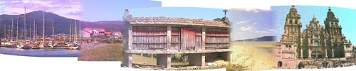
Factual information related to Galicia and northern Spain
This page offers some facts and statistics, primarily in the form of geographical and climatic information, about the region of Galicia in Spain.
Galicia's borders
To the west of Galicia lies the Atlantic Ocean and to the north, the Bay of Biscay (Mar Cantabrico). The south of Galicia is bordered by Portugal, while to the east is the "meseta" or central plateau of mainland Spain. There is also a significant mountain range, "Montanas de Leon", which runs north to south on the eastern border of Galicia, creating a physical barrier between it and the rest of Spain.
Geographic environmental status
Galicia is in a temperate zone, known as España Verde (Green Spain) and is classified as having both coniferous and deciduous forest types. This is aptly demonstrated through the pine and eucalyptus forests which cover this Spanish region. It also gives Galicia the unusual luxury of being able to grow palm trees along side annual flowers and leaf shedding shrubs.
Membership of International Bodies
Galicia, as a part of mainland Spain, is a member of the EU (European Union) and had second level entry into the United Nations (i.e. gained member status by 1955, but was not a founding member state). Spain itself also has many formal and informal trade and cultural ties with other Latino and Hispanic nations throughout the world, especially in South America.
Climate and weather
Temperatures and rainfall vary across the region. Close to the coast, temperatures average between 8ºC to 10ºC in winter and rise up to 20ºC to 25ºC in summer. Moving inland from the coast, the weather becomes warmer and drier and in the south of Galicia (around the rias baias) the temperatures can be as much as 5ºC warmer in summer.
There are contradictions to these broad statistics, one of which is "Santiago de Compostela" which, although inland and located mid-way down Galicia, has more rain than any other Spanish city.
We have personally found the summer temperatures around the Noia-Muros bay area to be between 25ºC and 35ºC during the months of July and August, but the published figures are based on summer long averages and obviously take in to account the poor weather days which I no doubt to forget.
If you are used to degrees Fahrenheit, then 28ºC = 82ºF, so any temperature above the mid twenties is suitable for sun bathing. Humidity can be unpleasant on a hot day in a large city, but near the coast there is always a breeze and if you ascend the hills inland it gets a little bit cooler.
Some statistics for Galicia
If you are into your "data", then here are some factual, but useless bits of geographical information about Galicia and its cities.
Galicia to where you are!
Below are a few distances (in km) from Santiago de Compostela in Galicia to some other major cities in Europe.
- London, England: 2080km
- Paris, France: 1600km
- Berlin, Germany: 2715 km
- Moscow, Republic of Russia: 4570km
- Madrid, Spain: 670km
- Dublin, Ireland: 2610 km
- Athens, Greece: 4475km
- Helsinki, Finland: 3880km
- Rome, Italy: 2530km
- Edinburgh, Scotland: 2730km
Geographic statistics for Galicia's largest cities.
If you want to pin-point "A Coruna", "Lugo", or any other major Galician conurbations on a map, here are the all important altitudes, latitudes and longitudes for the task. The altitudes are in metres above sea level and the other two metrics are in degrees, minutes and seconds - enjoy.
| Galician City | Altitude | Latitude | Longitude |
| A CORUÑA | 58 | 43 22 02 | 8 25 10 |
| A LUGO | 444 | 43 06 55 | 7 27 02 |
| OURENSE | 143 | 24 19 40 | 7 51 37 |
| PONTEVEDRA | 107 | 42 26 24 | 8 36 59 |
| SANTIAGO COMPOSTELA | 364 | 42 53 58 | 8 25 37 |
| VIGO | 255 | 42 13 25 | 8 37 55 |
Galicia's towns & cities
This list includes most of the larger towns and cities in this region of Spain. If the place in question has "provincial" or "major city" status, I have made a note to that fact. The places listed are in no particular order and I am sure to have omitted some by mistake.
|
La Coruna or Corunna city (major city & province) La Guardia Bayona Vigo (Galicia's most populated conurbation Bande Allariz Ourense or Orense (major city & province) Redoneia Pontevedra (major city & province) Cambados Padron Muros Noia C.Finisterre Corubion Mugia El Ferrola (major city) |
Betanzos Carballo Aruza Santiago de Compostella (regional capitol) Lalin Chantada Puebla de Trives El Barco de Valdeorras Quiroga Monforte de Lemos Sarria Lugo (major city & province) Baamonde Villalba Mondonedo Meira Fonsagrade Becerrea Villafranca del Bierzo Ponferrada C.Ortegal |
Galicia's Rivers
How many more meaningless facts can you provide, I hear you ask. Well how about the main rivers running through, across and in Galicia and its four districts. They are the:
Tambre, Ulla, Mino, Sil, Embalse de Belesar, Eo, Lima