Camino de Santiago - French Way - Stage 27, page 1
Villafranca del Bierzo to O Cebreiro
Total distance - 27.2 km

Walk down Calle del Agua and at the far end turn left by the statue of the pilgrim and walk across the Río Burbía. Once across the bridge you have 3 choices of route which are all clearly way marked. One low level route which follows the road down the valley or a choice of two high level routes, the choice you make will be determined firstly by the weather. If the weather is foggy or raining heavily don't attempt the higher level routes. The other will be determined by your fitness and how good your knees are.
We will give you details of all three routes below starting with the road route.
Once across the Rio Burbia walk past the convent and Iglesia de la Concepcion and keep walking until you reach the exit of the road tunnel through the mountains. Cross over here and take a right turn and walk for another 3 kilometres when you will take a right down an older section of the NVI road just before you enter the village of Pereje. There is a single albergue here as well as a bar.
Walk down the Calle Camino de Santiago to the end of the village where you rejoin the main road for about 2.5 kilometres and again you will take a section of the old road for about 1 kilometre and into the village of Trabadelo. There is a single albergue here and a hostal with a restaurant.
Again walking down the Calle Camino de Santiago keep walking ahead until you reach the spot where the motorway crosses the NVI and you then turn right onto the main road. Follow this road until you reach the Hostal Valcarce where you will take a left down the old road to Portela where you can fill up your water bottle at the fountain or get something to eat at the bar/restaurant.
At the end of the village turn left to rejoin the main road and at the junction take the route marked towards Ambasmestas and after about 4.5 kilometres you arrive in the village. Here are a couple of bars, one of which has a restaurant that offers a pilgrim's menu, a panaderia (bread shop) and an albergue.
The route now takes you through Ambascasas with the road viaduct above you and out towards the village of Vega de Valcarce. There are a couple of albergues in the village plus a number of the restaurants offer a pilgrim's menu. There are also a few shops, a bakery, a chemist to restock on your blister remedies and some banks. It's probably a good idea to stop here to get a good night's rest before you start the steep climb up the mountains to O Cebreiro.

If you choose to stay here the night you might want to take a look at the Castillo del Sarracin up on the hill above the town. It had once belonged to the Marqueses de Villafranca but it is more or less a ruin now but you do get some great views over the valley. It is about a 1 hour round trip.

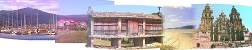
In the village there is a great example of an horreo or grain store. As you enter Galicia you will see different styles, usually made of granite or wood but this is a good example for this area. There is however a rather unusual carving in front of it, a bit spooky I think.
The Camino from this point onwards until you get to O Cebreiro climbs up through the mountains starting off gently but progressively getting steeper. Walk through Vega de Valcarce down the road for 2 kilometres until you reach the village of Ruitelán. There is an albergue here if you were unable to get a bed in Vega de Valcarce.
In another kilometre you come to the village of Herrerias where all three routes converge. The village derives its name from the iron forge that used to be here. There are a couple of bars that offer food with one of the bars containing a restored iron forge if you would like to take a look. At the end of the village the houses used to belong to the Hospital Inglés a pilgrim hospital.


Walk through the village and after about a kilometre you come to a track with 2 marker posts, one of the routes is for those doing the Camino by bicycle, the other is for those on foot. If the weather is bad follow the cyclist's route, if not follow the walker's route. The path climbs steeply through chestnut woods for about 3.5 kilometres before you walk down the Calle Santiago into La Faba. The village has a small shop and a café plus 2 albergues. One of them, the private Albergue Vegetariano is only open in the summer and only offers vegetarian meals.
Close by here, during the winter of 1809 when General Sir john Moore's army was retreating over the mountains heading for La Coruña they were caught in a blizzard. It was so bad that several hundred of his men froze to death and the remaining men mutinied throwing a large chest of gold over the cliff in protest. The General managed to regain order but he ended up being killed by the French at the battle of La Coruña.
Walk through the village and up a tree lined lane forking right when you come into the open and keep on walking uphill until you reach Laguna de Castilla in 2 kilometres. The albergue here is only open for a couple of months in the summer July and August. As you walk out of the village you come to the first of many marker stones which from now until you reach Santiago will appear every 500 metres. They are usually marked with a scallop shell and the name of the town or village in which you are in as well as how many kilometres you have left to go until you reach Santiago.
Keep walking straight through the village and after 1 kilometre you finally leave León and enter Galicia. This point is marked with a large marker stone. After another kilometre you come to the town of O Cebreiro.
Before I give you any more information on O Cebreiro I will give you details of the other 2 routes.
The second slightly longer route takes you via Pradela were there is a fountain but no other amenities and is clearly marked as are the other 2 routes. Unlike the road route this doesn't start off gently, this route is steep from the start. At the bridge in Villafranca del Bierzo take a right hand fork down Calle Pradra and walk along the steeply rising path for approximately 3 kilometres when the path continues to climb but not as steeply. After you have passed some television masts the road begins to descend. Turn left at the junction, Pradela is to your right if you want to stop for water. Follow the path and then across the road and down a steep gravel path into the Village of Trabadelo where you meet up with the flatter road route. From here you now follow the road route as I have described above.
The third and final route takes you via Dragonete and is not a route for the faint hearted, it is considerably longer and pretty arduous. You need to be pretty fit to embark on this route and you need to make sure you have plenty of food and water with you as the villages you pass through do not have any amenities.
Leave Villafranca del Bierzo over the bridge as mentioned previously but this time cross another bridge over the Rio Valcarce and walk down the Calle Salvador crossing the NVI at the road tunnel. Take a right hand fork up a tarmacked track at the signpost saying Dragonete 4.3. Keep following this track to the village of Dragonete. There is a fountain here if you need to replenish your water.
Walk through the village continuing along the tarmacked track and after about 2 kilometres you will come to a sign marked Camino de los Frances GR11, take this track and at the minor road take a left and continue descending into Moral de Valcarce where again there is a fountain.
Continued at Stage 27 - page 2.